Tendürek Dağı
- Volcano type: Shield
- Volcano number:213030
- Latitude: 39.356°N
- Longitude: 43.874°E
- Elevation: 3514 m
- Distance to Ankara: ~950 km
- Closest major city: Doğubeyazıt, ~25 km
- Population within 5 km: 550
- Population within 10 km: 5,060
- Population within 30 km: 173,581
- Population within 100 km: 1,938,900
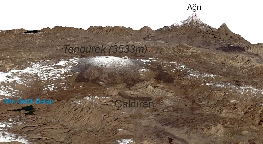
Tendürek volcano is located on the provincial border of Van-Ağrı and is a shield type volcano. It covers an area of approximately 600 km² in the southwest of Ağrı Mountain. It rises immediately on the Iranian border in the east. The closest settlement is Çaldıran, located to the south of the volcano, Diyadin to the northwest, and Doğubeyazıt to the northeast. Tendürek volcano has a flat topography and its peak is 3533m high. There is a crater at the top of the volcano. There is Küçük Tendürek Crater (3291m) with a small lake in the east of the summit crater.
Many cone and craters are located around the volcano. Tendürek, which is one of the main actors of Eastern Anatolian volcanism, has been located in the northeast of Van Lake with its historical explosion records, products covering large areas and special morphological elements. At the summit of the volcano, there are fümerol activities and gas outlets and the young volcanic products erupted from the Tendürek reached the Mount Ağrı.
Lebedev et al. (2016) stated that the development of Tendürek volcano that started in late Quaternary continued for 250 thousand years. Based on geological, geochronological and geomorphological data, it is stated that Tendürek volcano is potentially active (Lebedev et al., 2016).
Holocene activity of Tendürek volcano is based on historical records. In Karakhanian (2002), Alishan (1890) mentions the explosion of gas and ash in the village of Topariz, 12.5km south of Doğubeyazıt in 1855. The youngest volcanic eruption record in Turkey is this eruption. Fumerole activities still continue on the volcano.
References
Alishan, G. 1890. Airarat. Venice.
Global Volcanism Program, 2013. Tenduruk Dagi (213030) in Volcanoes of the World, v. 4.7.7. Venzke, E (ed.). Smithsonian Institution. Downloaded 19 Apr 2019 (https://volcano.si.edu/volcano.cfm?vn=213030).
Karakhanian, A., Djrbashian, R., Trifonov, V., Philip, H., Arakelian, S., Avagian, A. 2002. ‘’Holocene-historical volcanism and active faults as natural risk factors for Armenia and adjacent countries’’, J. Volcanol. Geotherm. Res., 113, 319-344.
Lebedev, A.V., Sharkov, E. V., Ünal, E., Keskin, M., 2016. ‘’Late Pleistocene Tendürek Volcano (Eastern Anatolia, Turkey): I. Geochronology and petrographic chararcteristics of igneous rocks’’, Petrology, 24, 127-152.
Ulusoy, İ. 2016. ‘’Temporal radiative heat flux estimation and alteration mapping of Tendürek volcano (eastern Turkey) using ASTER imagery’’, Journal of Volcanology and Geothermal Research., 327, 40-54.
Ünal, E. 2018. ‘’Tendürek Volkanının Volkanostratigrafisi, Petrolojisi ve Magmatik Evrimi’’ Doktora Tezi, Van: Yüzüncüyıl Üniversitesi Mühendislilk Fakültesi Jeoloji Mühendisliği Bölümü.