Göllüdağ
- Volcano type: Lava dome
- Volcano number: 213003
- Latitude: 38.25°N
- Longitude: 34.57°E
- Elevation: 2143 m
- Distance to Ankara: ~240 km
- Closest city: Niğde, ~30 km
- Population within 5 km: 835
- Population within 10 km: 20,644
- Population within 30 km: 155,618
- Population within 100 km: 2,049,981
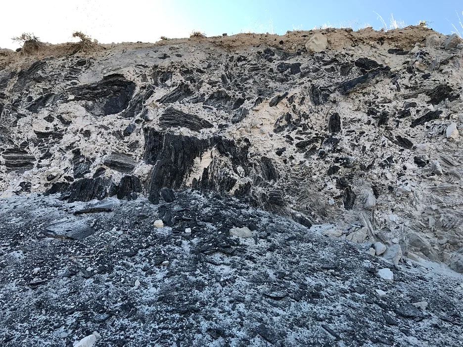
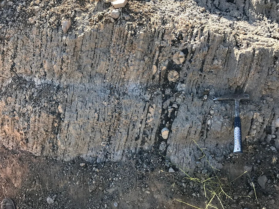
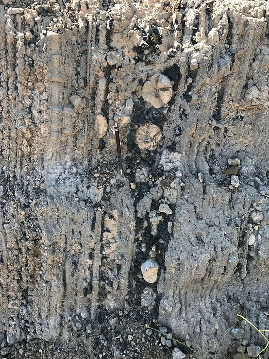
Göllüdağ is a complex of lava domes with related cinder cones, between Hasan Dağ and Acıgöl in Central Anatolia. The lava domes and cinder cones overlie the Tertiary-age Derinkuyu caldera. Activity is dominantly rhyolitic to rhyodacitic, with extensive obsidian deposits. The obsidians are dated from 1.33 to 0.84 million years (Bigazzi et al., 1995). Numerous cinder cones have formed along N-S fissures north of Göllü Dag and south of the Erdas Dag massif.
There are Domes of Büyük Göllüdağ and Küçük Göllüdağ at the top of the volcano. 0.4my K / Ar ages from Küçük Göllüdağ, 1.1my from Kaletepede, 0.8my from Büyük Göllüdağ (Mouralis et al., 2019).
Keller (1980, in GVP) considers some cinder cones to have formed in the Holocene due to their fresh appearance, and hydrothermal alteration and hot springs suggest that the area is still active.
References
Bigazzi, G., Yeğingil, Z., Boztuğ, D., Ercan, T., Norelli, P., Özdoğan, M. 1997. ‘’Studi di proveinenza della obsidiana con il metodo tracce di fissione: nuovi dati sulle potenziali fonti anatoliche’’, IV. Giornata “ Le Scienze della Terra e l’Archeometria”, Neaples. 20-21 Feb. 1997, Abstracts, p.33.
GGlobal Volcanism Program, 2013. Gollu Dag (213003) in Volcanoes of the World, v. 4.7.7. Venzke, E (ed.). Smithsonian Institution. Downloaded 18 Apr 2019 (https://volcano.si.edu/volcano.cfm?vn=213003).
Mouralis, D., Pastre, JF., Kuzucuoğlu, C. Türkecan, A., Guillou, H. 2019. ‘’Tephrostratigraphy and chronology of the Quaternary Gölludağ and Acıgöl volcanic complexes (Central Anatolia, Turkey)’’, Med. Geosc. Rev., 1, 179. https://doi.org/10.1007/s42990-019-00010-8.